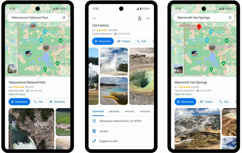
National parks across the United States are renowned for their stunning landscapes and wildlife, but not always for reliable cell service. Many of these parks are situated in remote areas where wireless reception can be weak or nonexistent, posing a challenge for visitors trying to navigate the vast expanses.

Preparing Your Maps Offline
To address this issue, Google Maps introduced a handy feature in April 2023 that allows users to download maps for offline use, including all U.S. national parks. Here’s how you can prepare:
- Download Maps Ahead of Time: Before your trip, open the Google Maps app on your smartphone and search for the name of the national park you plan to visit. Once you’ve selected the park, scroll down to the bottom of the screen and choose “Download for offline use.”
- Confirm the Download: The app will prompt you with a confirmation message asking if you want to download the map. Select “Download,” keeping in mind that this will use some storage space on your phone. Once the download is complete, the app will notify you with a message stating, “Download is complete. Just use Maps normally, even when offline.” Note that the download will expire in a year unless updated.
Features and Benefits of Offline Maps
Once you arrive at the national park and lose cell service, you can rely on your offline map for navigation. Here’s what you can expect:
- Dynamic Location Tracking: The offline map will display your location as a dynamic blue dot, allowing you to navigate trails and locate amenities like restrooms without needing an internet connection.
- Key Attractions and Trails: Google Maps provides highlights of key attractions within the park, complete with photos, detailed descriptions, and reviews from the community. You can also access maps of popular trails, along with crowd-sourced photos, tips, and reviews from fellow users.
- Detailed Directions: The app offers comprehensive directions to park entrances and trailheads, whether you’re traveling by car, bike, or on foot. This ensures you can find your way around the park with ease.
Additional Tips for Park Visitors
While Google Maps offline is a valuable tool, it’s always a good idea to supplement your digital maps with local knowledge:
- Visit Visitor Centers: Stop by park visitor centers to speak with rangers in person. They can provide up-to-date information, suggest specific trails based on your interests and abilities, and offer safety tips.
- Grab a Park Brochure: Pick up a park brochure that includes a paper map as a backup. These brochures are available at visitor centers and include essential information about the park’s amenities, trails, and safety guidelines.

By using Google Maps offline and combining it with local advice, you can make the most of your national park experience, ensuring a safe and enjoyable visit even in areas with limited cell service. Whether you’re exploring iconic landmarks or embarking on a scenic hike, being well-prepared enhances your adventure in these natural wonders.
