Federal forecasters announced on Thursday that the powerful “super” El Niño has officially ended. In its place, the La Niña climate pattern is expected to emerge over the next few months. The Climate Prediction Center forecasts a 65% chance of La Niña developing during the summer and an 85% chance of persisting through the winter of 2024-25.
Transition from El Niño to La Niña
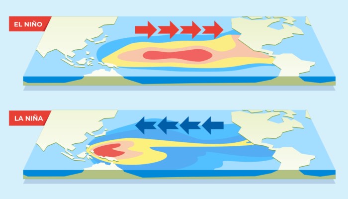
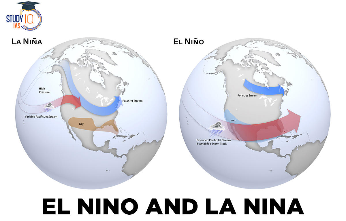
La Niña, known for creating weather patterns that boost hurricane activity in the Atlantic Basin, is set to take over. This transition is significant as El Niño typically suppresses hurricane activity in the Atlantic, while La Niña has the opposite effect. La Niña’s influence extends beyond hurricane activity, affecting winter weather in the U.S. and globally.
The Climate Prediction Center indicates that La Niña can increase Atlantic hurricane activity by reducing wind shear over the Caribbean Sea and tropical Atlantic basin, conditions that are conducive to storm development and intensification. This shift is one of the reasons forecasters predict a “hyperactive” hurricane season this year, with estimates of up to 33 named storms, compared to an average of 14.
Impact on Atlantic Hurricane Season
Although La Niña has not yet fully developed, forecasters say we are currently in an “ENSO-neutral” phase, a transitional period between El Niño and La Niña. The Climate Prediction Center’s monthly update confirms that sea surface temperatures in the Pacific Ocean are neither unusually warm nor cool, indicating neutral conditions.
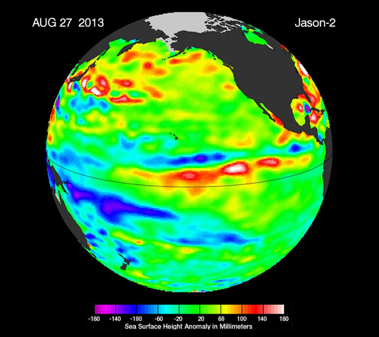
El Niño, characterized by warmer-than-average sea surface temperatures in the central and eastern tropical Pacific Ocean, occurs every two to seven years. The entire climate cycle, known as the El Niño-Southern Oscillation (ENSO), includes the warming (El Niño) and cooling (La Niña) phases. ENSO-neutral conditions are declared when sea temperatures are average.
Weather Patterns and Predictions
La Niña typically brings cold and snowy conditions to the U.S. Northwest and unusually dry conditions to the Southern states during the winter. The Southeast and mid-Atlantic regions often experience higher-than-average temperatures, while New England and the Upper Midwest, including New York, tend to see lower-than-average temperatures during a La Niña winter.
The outgoing El Niño was one of the strongest recorded, according to the World Meteorological Organization (WMO). This powerful El Niño, combined with ongoing climate change, contributed to record-high global temperatures in 2023. WMO deputy secretary-general Ko Barrett emphasized that while El Niño’s end is significant, it does not signal a pause in long-term climate change, as the planet will continue to warm due to greenhouse gases.
As La Niña takes hold, its effects on weather patterns, particularly in the Atlantic hurricane season, will be closely monitored. The anticipated increase in hurricane activity underscores the importance of preparedness for potentially severe weather in the coming months.